Stephen Thomforde 2017
Introduction:
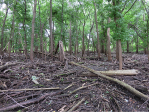 In this document the floodplain is defined as the flat plain between the river and the blufflands that fills with water during flood events. This interpretation is based on elevation without any consideration of vegetation or soil classification. This document further constrains the definition of floodplain by soils which are alluvial in origin. The floodplain soils, derived from river sediments, silt and sand, facilitates a different vegetation and fauna than the organic soils at the base of the blufflands, independent of elevation. This criterion limits the floodplain to the southside of the lakes, marshlands, and wetlands and does not include the north side of the lakes, marshlands, and wetlands where soils are organic material in origin. The wet plain of organic soil origin is treated as wetlands and marshlands.
This particular floodplain is found in Bloomington, MN, but serves as a general principle for other regional floodplains. This document also serves us to recognize the power of narrative, and how a term, such as “floodplain forest”, can drive a paradigm, even when evidence exists to suggest otherwise, but a decade of expert mapping, labeling, and BMPs, and the paradigm becomes enshrined as truth. This represents a classic example of what the great ecologist C.S. Holling (1996) described as, “command and control and the pathology of resource management”.
Historic State:
The current narrative for Midwest floodplain vegetation is forest as “original vegetation”; however, there’s no convincing evidence to support this assumption, and plenty of evidence to suggest otherwise. Official lines of evidence to suggest an alternative to floodplain forest include: 1) written descriptions by Johnathan Carver 1766 -67 (Carver 1778), 2) written descriptions by U.S. Captain Zebulon Pike in 1806 (Pike 1878), 3) paintings by military artist Seth Eastman (Circa 1847) (Pictures 1 – 2), 3) Public Land Survey (PLS) bearing tree data and field notes (circa 1853) (Picture 3 – 4) historic aerial photos (https://www.lib.umn.edu/apps/mhapo/), 5) presence of ancient open growth form black willow, cottonwood and silver maple trees in densities of < 11 mature trees/acre (Picture 9 – 10), 6) presence of remnant wet and wet mesic grassland vegetation obligate to > 50% sunlight (e.g. Virginia wildrye, lake sedge, wild golden glow, and wild iris), 7) presence of wet and wet mesic grassland species obligate > 80% sunlight in mowed RW (e.g. Arkansas rose, marsh milkweed, blue joint grass, golden Alexanders, and common milkweed, and 7) extremely low species quality index values associated with the current vegetation that suggest the current afforested state as a novel assemblage rather than a highly evolved community.
These early official descriptions of the Minnesota River Valley in Bloomington should not be considered the original vegetation, for by the time these descriptions were developed, the fur trade had been in place for 110 – 160 years, and keystone herbivore populations (beaver, elk, bison, deer, passenger pigeon) had been essentially eliminated. Likewise, Native Americans obtained fire arms, traps, and contributed to the fur trade, both furs and bush meat. The killing of game was immense and by the mid-1800s, herbivores were absent from the land, a twenty-million-year coevolution between vegetation and herbivore was broken, and vegetation without herbivory was released. Therefore, it’s more likely these early descriptions are capturing the beginnings of a transitioning state, following the removal of herbivores and Native American fire, that facilitated an expansion of woody vegetation (Picture 5). Carver describes walking through the floodplain following elk trails through the tall grasses (Carver 1778), and Pike notes elk and bison had been regionally common up until the early 19th century, but the fur trade and establishment of Fort Snelling (1819) forever ended that 20-million-year relationship between the native mega-herbivore and native vegetation (Vera 2001).
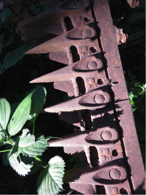
Some of the earliest and best quantifiable descriptions of the Minnesota River Valley in Bloomington come from Seth Eastman paintings (Circa 1847) showing a more open landscape than exists today. Trees do appear in these paintings, but in scattered groves, probably where wetlands and steep ravines created strong fire shadows. Ground layer vegetation appears to be dominated by grassland species. The 1853 PLS bearing tree data and field notes indicate cottonwood and maples present throughout the Bloomington floodplain, but in such low densities as to only include six bearing trees in the floodplain, and only one on current Bloomington property, a cottonwood on the east side of the Nine Mile Creek-Minnesota River confluence. These trees may have gotten their start during the peak fur trade period 160 years prior to the PLS. The earliest aerial photos (1937) show farming in the floodplain, and its unlikely settlers (circa 1880s) cleared a floodplain forest with primitive hand tools and oxen. Felling and bucking a floodplain forest would have created immense work, and the softwood has little value for either fuel or lumber. Floodplains offered early farmers “marsh hay” and remains of a horse-drawn sickle bar mower lies just west of the Nine Mile Creek Minnesota River Confluence (Picture 4).
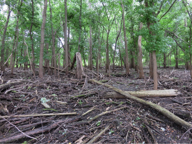
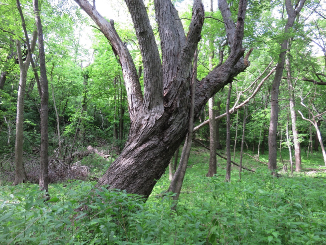
Additional evidence to reject the current floodplain forest paradigm comes via species quality analysis of associated vegetation. Species associated with the deep shade floodplain forest state exhibit extremely low Species Quality Indexes (SQI). The dominate floodplain trees exhibit poor structural quality, provide non-edible fruits and forage, and slough nutrients that eutrophicate the surrounding environment. The nutrient input occurs through shedding copious amounts of labile wood, leaves, bud scales, floral structures and seeds that rapidly decompose and release nutrients to both terrestrial and aquatic environments, reinforcing the low-quality state (Picture 5). The combined species scores for the dominate vegetation in the floodplain forest make the floodplain forest the lowest quality community in our region, in fact so low that the floodplain forest seems to be a novel assemblage rather than a highly evolved community.
Low quality species provision few if any ecosystem services, in fact, low quality ecosystems often erode natural capital provisioned by a former high-quality state. When we compare ecosystem services provided by an open-canopy floodplain to a closed-canopy floodplain forest, we see significant declines in ecosystem services for the closed-canopy state. For example, the open-canopy floodplain, dominated by perennial graminoid vegetation, builds soils and sequesters a significant amount of carbon into long term below ground storage. Contrarily, the closed-canopy floodplain, dominated by annual dicots (e.g. wood nettle), or bare soil, provides poor soil protection, and erodes soils during flooding, which contributes to turbidity. Likewise, floodplain forest vegetation allocates most carbon to above ground structures, that in turn rapidly decompose CO2 into the atmosphere. Another comparison can be made between the open and closed-canopy states for nutrient regulation. The open-canopy floodplain ecosystem strongly regulates nutrients, including carbon, nitrogen, and phosphorus, through highly evolved food webs, recalcitrant structures, and deep root systems. The novel floodplain forest ecosystem, dominated by labile and non-edible species, rapidly liberates nutrients, whereby highly competitive organisms, such as cyanobacteria, green algae, wood nettle, and silver maple rapidly assimilate nutrients, and in turn reinforce the low-quality state.
The pathology of resource management describes the afforested state preferable to the open grassland state when it’s dominated by reed canary grass (RCG), because supposedly RCG is non-native. However, in review of aforementioned species contribution to ecological integrity, the grassland state stabilizes soils, regulates nutrients, and is edible in it pre-bloom state. Compare the grassland state’s capacity to deliver ecosystem services to the afforested state, that liberated both soils and nutrients to the abiotic environment and supplies little if any edible structures for wildlife. A field of RCG can be grazed, mowed or hayed in ways that can facilitate increase in ecological integrity and diversity. The primary take home of this paragraph shows the pathology of resource management, whereby the potentially non-native grass that supplies significant ecosystem services is considered undesirable to a low-quality native woody vegetation that erodes ecological capital and contributes to declines in ecological integrity.
From a species quality and ecosystem services perspective, floodplain forests provide the lowest ecological quality and poorest ecosystem services of any original vegetation. Also, the lack of historic evidence showing floodplain forest as “original vegetation” and the corresponding evidence suggesting a more open landscape forces us to consider possible alternatives. This might be a hybrid, between forest and open grassland vegetation. The classification might be “wet-mesic savanna” or “wet-mesic meadow”, or “lowland savanna”. Evidence suggests historically oaks grew in the floodplain (PLS 1853), and bur oak are considered tolerant to normal flooding (Fowells 1965), but not to the current, extreme, unpredictable, and rapid flooding associated with today’s excessive drainage and runoff. The only trees tolerant to this force are predictably weedy nitrophiles such as silver maple, ash and to some extent cottonwood. Although far lower in quality than the oaks, if these trees are tolerant to current conditions, then we should allow their membership, but in ways that mimic historic community savanna structure.
Transitional and Current States:
Farming and human inhabitation of the Bloomington Minnesota River Valley ended 60 years ago; however, this should not be considered normal, as humans have lived in and managed the floodplain for food for 9000 years. When humans and their animals, rather native Americans managing for elk with fire, or settlers grazing Holsteins and cutting hay, left the valley, the modern grasslands lost their reinforcing controls and devolved into primitive woodlands. Grasslands represent the most evolutionarily advanced, productive and provisional terrestrial ecosystem ever, while forest configurations are far more ancient and less productive and provisional.
Restoration:
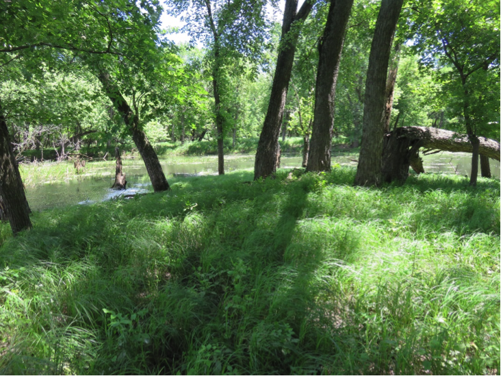
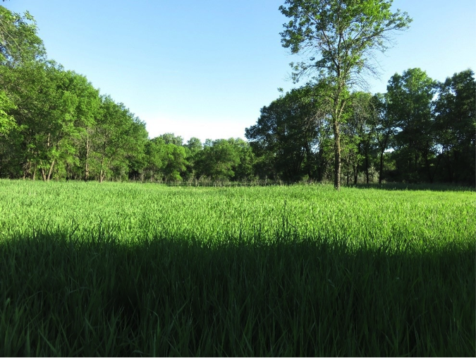
The vision for floodplain restoration is to create a mosaic of shady and sunny patches with continuous perennial ground layer vegetation cover by high quality plants (Pictures 6). Restoration targets floodplain savanna, with fewer than 7 mature trees/acre (60 years old for fast growing species), with enough sunlight to maintain continuous ground layer vegetation. The diversity of habitats coupled to more edible vegetation, will enhance wildlife diversity. Greater graminoid cover will also reduce soil erosion and provides a much more efficient long-term carbon storage mechanism than the current afforested state. Finally, this type of vegetation can be controlled from reverting towards a lower quality assemblage by mowing, haying, burning and grazing.
Floodplain restoration require three steps, including: 1) removal and thinning undesirable vegetation and excessive dead down wood, 2) reintroduction of desirable species, and 3) restoring the processes that reinforce a desirable biotic assemblage. The third step, in the long term, is the most important step, but also the most neglected step in our current restoration planning. In the case of the Bloomington floodplain, these processes include mowing, prescribed fire, haying, and grazing. Mowing is the very minimum to maintain open understories and preventing a return of the closed-canopy state. Initial tree thinning design needs to facilitate, at the very least, mowing. Prescribed fire is very feasible in the Bloomington floodplain, as natural fire breaks, including the Minnesota River, marshes and small lakes provide adequate technical assistance. Haying provides an excellent mechanism for preventing afforestation and lowering nitrogen levels. Lower soil nitrogen levels facilitate high plant biodiversity. Haying wetlands for marsh hay was once common, and known to reinforce high biodiversity of both plants and animals (Curtis 1959 {last paragraph in shrub carr community}, Leopold 1949 {Marshland Elegy}). Native marsh hay is highly nutritious, and this year (2017) every bale would have been highly marketable to the drought stricken Dakotas. Lower quality hay, composed of non-native and nitrophilic species (nettles, ragweed, cattail, etc.) is used for biomass fuels in Winnipeg, where haying is used to harvest nitrogen before entering Lake Winnipeg from the Red River.
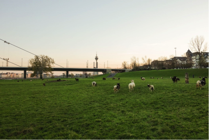
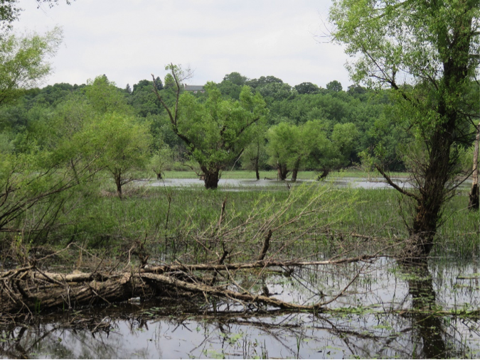
Where feasible, grazing offers the ultimate restoration target. Grazing prevents afforestation, lowers total soil nitrogen, creates heterogenous vegetation patterns, significantly improves wildlife habitat, and provides food and fiber for humans. Grazing the Bloomington floodplain is feasible, and the conceptual discussion should begin. Picture 7, shows small ruminant herbivores grazing the Rhine River floodplain in Dusseldorf, Germany, with a human population of 11 million. Colman Lake floodplain offers a good opportunity to reemploy grazing in Bloomington (Picture 8).
Pictures:


Reference Section:
Carver, J. 1778. The Journals of Jonathan Carver and Related Documents 1766-1770. Edited by John Parker. Minnesota Historical Society Press.
Curtis, J.T. 1959. The Vegetation of Wisconsin. An Ordination of Plant Communities. University of Wisconsin Press.
Fowells, H.A. 1965. Silvics of Forest Tress in the United States. Agricultural Handbook No. 271, p. 726
Holling, C. S., & Meffe, G. K. (1996). Command and control and the pathology of natural resource management. Conservation biology, 10(2), 328-337.
Leopold, A. 1949. Sand County Almanac. Oxford Press
Pike, Z. M. (1895). The Expeditions of Zebulon Montgomery Pike: To Headwaters of the Mississippi River, Through Louisiana Territory, and in New Spain, During the Years 1805-6-7 (Vol. 1). E. Coues (Ed.). Francis P. Harper.